Thma Bang District (Thma Bang)
Thma Bang District is one of six districts (srok) and a municipality of Koh Kong Province in south-west Cambodia. It is about 72 km from central Koh Kong. Thma Bang district is bordered on the east by Sre Ambel District and Aoral District of Kompong Speu Province, on the west by Koh Kong District and Mondol Sima District, on the north by Velveng District and Krovanh District of Pursat Province and on the south by Botumsakor District. Thma Bang district has 6 communes comprising to 17 villages and occupies 3465 km2. About 98% of the population are farmers who depend on agriculture and forest resources hunting for living.
Map - Thma Bang District (Thma Bang)
Map


Country - Khmer_Republic
 |
 |
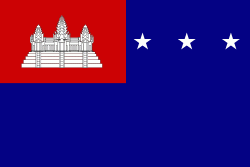
| Flag of Cambodia | |
The main cause of the coup was Norodom Sihanouk's tolerance of North Vietnamese military activity within Cambodia's borders; Vietnamese communist forces had gained de facto control over vast areas of eastern Cambodia as a result. Another important factor was the dire state of the Cambodian economy, an indirect result of Sihanouk's policies of pursuing neutrality.
Currency / Language
| ISO | Currency | Symbol | Significant figures |
|---|---|---|---|
| KHR | Cambodian riel | ៛ | 2 |
| ISO | Language |
|---|---|
| KM | Central Khmer language |
| EN | English language |
| FR | French language |